Shopping Cart
0 item(s) - U$0.00- Agriculture +
- Anthropology
- Archaeology
- Arts & Photography +
- Bangladesh Studies
- Bengali Books
- Biographies & Memoirs +
- Business, Economics & Investing +
- Children's Books
- Development Studies
- Education & Reference +
- History +
- Home, Garden & Hobbies +
- Journals & Reports
- Law +
- Literature & Fiction +
- Population and Housing Census
- Reference Book +
- Religion & Spirituality +
- Sciences & Technology +
- Social Sciences +
- Travel +
- Women's Studies
- Statistics
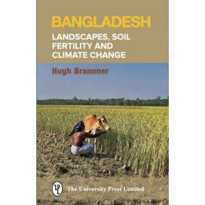
Bangladesh: Landscapes, Soil Fertility and Climate Change
Authors: Hugh Brammer (Author)
Edition: 1st Edition
Year: 2016
ISBN: 9789845062350
Page: 200
Format: Hardcover
Language: English
Product Code: 5285
Availability: In Stock
Condition: New Book, Never used
Qty:
This book aims to puncture two popular myths: that Bangladesh is a flat alluvial plain where soil fertility is maintained by silt provided by annual floods; and that the country will be overwhelmed contour by contour by sea-level rise in the 21st century which will displace many million people.
Bangladesh is, in fact, a country of great physical diversity and complexity, illustrated in this book by numerous satellite images. Its floodplains are mainly flooded by rainwater, not by river water, and it is chemical and biological reactions taking place in flooded soils that contribute to their fertility.
Analyses of 50 years of recent climate data show no evidence that Bangladesh’s climate has changed significantly due to global warming to-date, and practical measures are available to counter adverse effects of the slowly rising sea-level. The foreseen rates of climate change and sea-level rise in the 21st century are much slower than the social and economic changes that are occurring due to rapid population growth, and it is urged that the latter changes be given priority attention in development planning.
The book provides a summary of the author’s two recent books on the country’s physical geography and on climate change. It is aimed at government and donor officials, NGOs, academics, students, journalists, politicians and the general public who need to be aware of the diversity of Bangladesh’s physical geography and the variability of its climate, and the relevance of that diversity and variability for development planning. The book is being produced in English and Bengali editions.
Contents:
1. Introduction / 2. Geology / 3. Geomorphology / 4. Climate / 5. Hydrology / 6. Soils / 7. Physiographic Regions / 8. Climate Change / 9. Sea-Level Rise / 10. Implications for Development
Write a review
Your Name:Your Review: Note: HTML is not translated!
Rating: Bad Good
Enter the code in the box below:
Do you have any questions about Bangladesh: Landscapes, Soil Fertility and Climate Change?
 Your Name:
 Your Email:
 Your Question:
Enter the code in the box below:


 (
(